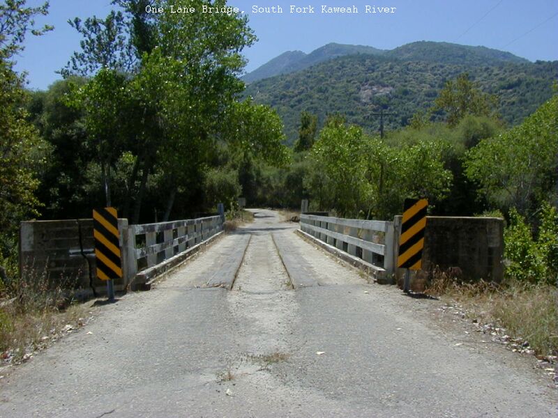
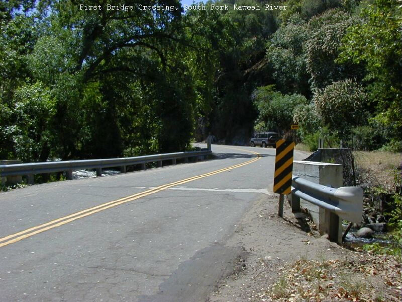
This is the usual run that is done on the South Fork. It is fairly clean and worth doing if you haven't done it before. The best take-out is to boat all the way to the lake. The Hwy 198 bridge is 0.5 miles above the confluence.
by Bill Pooley.
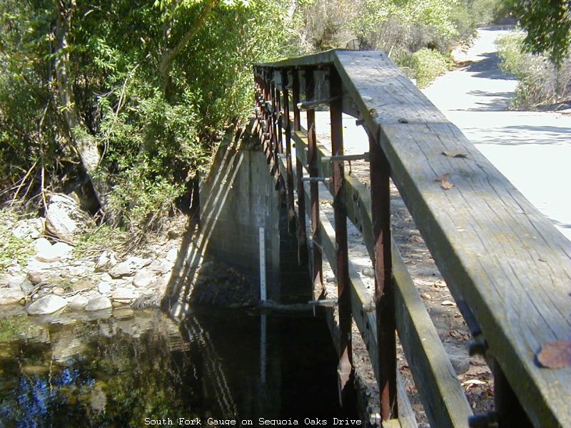
The South Fork Kaweah was first run in 1998 and is still the most seldom run tributary of the Kaweah. It is not as clean as other Kaweah runs but it is much improved the last few years due to local boaters efforts annually to cut out the hazards. The runable range is narrow and there is not a level that is perfect for all stretches at once. If the saddle rock 100 yards above the Hwy 198 South Fork Crossing is spilling in the center of the saddle then venture up to the gauge for a better look before deciding on your run. The higher you go, the less water is needed.
Rumor has it that this section has been attempted several times with varying degrees of success and disaster. If you're up for high gradient dangerous river exploring you'll figure out what you need to do. The river adjoins private land for it's entire length. A few glimpses of the river can be obtained from the road high above on the right bank. There is a 25 ft. falls in this section that is a favorite secret swimming hole for the locals.
Mile by mile river gradient:
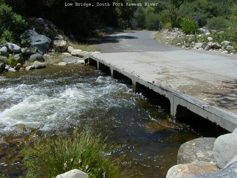
There is easy access to both the put-in and take-out. A very Low Bridge a half mile above the takeout is VERY DANGEROUS AND UNRUNABLE. Scout the low bridge before your run. This section of river was explored in May 1999 at 225 cfs. We had looked at it the year before at 350 cfs and determined it might be a bit pushy for a first descent. Once on the river we were glad we had delayed the trip until the level was lower. The river was found to be narrow, tight, and steep. One stretch in the upper part of the run was set on solid granite, creating some big hydraulic action and one high speed sliding drop. 225 cfs was plenty of water. Eddies are small and there was only one pool I remember. This section of river is going downhill fast. The run passes by the ranch of actor William Shatner, Captain Kirk, on the left bank.
This description is from a first hand run in the summer of 1998 at 350cfs. The run was combined with the run downstream. This section of river is, for the most part, runable. A quarter mile downstream of the bridge is the biggest drop of the run, a 4+ three decked affair we named Blackberry Slurry for it's impossible portage in over-your-head blackberries and a nearly as difficult scout from river right. Once in the micro eddy it is impossible to move upstream, downstream or across the river. The only possibility is get out and scout by wading hip deep to a large 10 foot boulder and then running the drop. We ran it without difficulty. The outrun is in a pool, one of few if not the only pool on this run. Two more bigger than normal rapids were encountered. We named them Turmoil and Pinball. There was a nasty log jam encountered at one point that had a single runable slot adjacent. Be prepared to get out and scout anything you can't see. There are few eddies on this stretch but for the most part there is good visability downstream. When you see the takeout bridge take the left channel above the bridge to the eddy on the left.
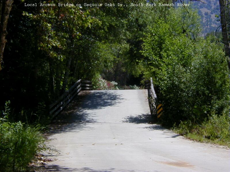
This section of the South Fork is UNRUNABLE due to severe strainer hazard, overhanging blackberrys, brush, nettles, logs, braided channels and the like. You will not like it if you boat into this section below the local access bridge. The quarter miles sections at each end of this stretch are runable but the logistics and access through private property make it impractical.
From the writup of the first descent of this section in 1998: When the river braids it's Time to head for the road on river left.
We made the mistake of boating beyond the last take-out bridge and descended into the unrunable section. Unrunable means 10 foot high
blackberries on both banks, steep drops, narrow channels and logjams. Our hike out of the Amazon Zone took an hour of hacking through
blackberry vines, nettles (yes Nettles!!), fire ants, and poison oak to go 100 feet to the left bank. Save yourself the trouble and take
out at the local access bridge before you enter the Amazon. It's a mile mile walk on the road to the next bridge where the boating begins again.
2003 Update: There has been some improvement done in this section and it had been reported to be more passable as a result of the clearing.
This is the usual run that is done on the South Fork. It is fairly clean and worth doing if you haven't done it before. The best take-out is to boat all the way to the lake. The Hwy 198 bridge is 0.5 miles above the confluence.